Borders
Lanarkshire
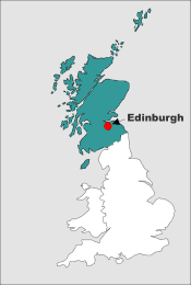
Edinburghshire & Borders branch
So far, we have 183 people on this tree, including some connections to Johnstones and Johnstone-Hopes.
The early family

Photo by Pierre Bamin on Unsplash
The main Fairholm/e family line stems from Thomas, the seventh son of John, "1st of Craigiehall', who married Elizabeth Couper around 1663, and had 5 children from 1664-1670 in Edinburgh. The had extensive business and landed interests. From the early 1700s, they gradually migrated southwards through the Borders and into England, so that today there are virtually no members of this branch left in Scotland. Early references show that their surname was sometimes spelt in records with an 'e', but sometimes without. It became standardised as Fairholme in the late 1700s.
George Fairholme (1789 - 1846) & geology
A general view of the geology of scripture, in which the unerring truth of the inspired narrative of the early events in the world is exhibited, and distinctly proved, by the corroborative testimony of physical facts, on every part of the earth's surface. 1833.
New and conclusive physical demonstrations both of the fact and period of the Mosaic deluge, and of its having been the only event of the kind that has ever occurred upon the earth. 1837 and 1840.
Copies of the books are held at the British Library and at libraries in Scotland. George also wrote articles on other physical and naturalist subjects.
There is an interesting article about George and his ideas at https://answersingenesis.org.
James Walter Fairholme (1821 - 1851?) & the Franklin Expedition
James Walter Fairholm
A daguerreotype by Beard
From Gleason’s Pictorial Drawingroom
Companion 18 October 1850
The text on the memorial says:
To the memory of James Walter Fairholme, Lieutenant R.N. born January 10th 1821. After a career of activity and enterprise he sailed in 1845 with Sir John Franklin in H.M ship Erebus, in company with the Terror. Both ships were abandoned after having completed the discovery of the North-West Passage. The officers and crew all perished in the Artic regions.
The darkess is past, and the true light shineth' 1 John, xi, ver. 8
The larger map shows the route of the expedition based on the only written evidence found (in 1859). In the second year, the expedition had amazing success and the ships seem to have been sailed down Peel Sound and, what is now called, Franklin Strait. No doubt, the crews recorded the coastline, obtained botanical samples and took photographs using their daguerreotype.
Problems began when the ships met the ice flow moving down, what is now named, M’Clintock Channel into Victoria Strait and they became trapped. They remained locked in the ice and moved with it for 19 months. Sir John, 8 other officers & 12 men died between May 1847 and April 1848. With the ships still trapped and supplies unlikely to last a further winter the 105 surviving officers and men began a 250 mile march to Great Fish River. At this point the written records end. The rest of the story has been pieced together by explorers from physical finds and oral evidence from the ‘Esquimaux’.
Exactly what happened is unclear, but at least two, possibly four, boats were dragged on sledges by the crews in the direction of Great Fish River, although their purpose in going there is unknown. It has been assumed that they were seeking fresh meat and then might have ascended the river for 1,000 miles to the Hudson Bay company’s outpost on Great Slave Lake. Material from the passage of the crews litters the western and southern coasts of King William Island and part of the North American mainland, but it seems that not all the crew proceeded towards Great Fish River - the Inuit saw evidence of recent occupation of one of the ships, a dead body on board and four sets of European boot prints in the Spring of 1849, around the time that it sank.
Death from scurvy, starvation (there is evidence of cannibalism) and, possibly, lead & food poisoning reduced rapidly the size of the party aiming for the river. One boat and at least 30 of the party made it within 30 miles of their immediate goal, to a place later called Starvation Cove, but got no further. The Inuit found their bodies. A more recent assessment suggest only 7 or 8 got that far. It seems likely that most of the expedition members had died by the winter of 1848-1849 - it was one of the worst summers & winters that the Inuit recalled.
All of the many rescue attempts failed, partly because they were looking in the wrong place. It was not until the M’Clintock expedition of 1859 that the fate of the crews was discovered. Where, how and when James died is unknown. A court case into the inheritance from his uncle was decided in 1858 and, based on the evidence of arctic experts, it was determined that he must have died by Autumn 1851. The only trace of James is his silver cutlery recovered by explorers from Erebus Bay and by barter from the Inuit. Three pieces are now in the National Maritime Museum, London, together with many other expedition artifacts. James’ memory is recalled by two islands and a bay named for him by later explorers - as shown on the larger map - and a seven foot high marble and bronze memorial at Holy Trinity church, Melrose - shown in the image to the left.
In September 2014 the Erebus was located on the bottom of the sea and the ship's bell was retreived. The ship was in remarkably good condition and further investigations are planned.
Update 1 - The ships
In September 2016 the Terror was located. The locations of both ships are shown on an updated version of the maps below.
There are several videos available on-line showing the submerged ships - including parts of the interiors. Hundreds of artefacts have been found aboard both ships. The artefacts are in good condition because of the low temperature of the sea. If the archeologists have identified a room correctly then the finds include the epaulettes from James' dress uniform - stored in a drawer under his bed. The archaeologists hope that future exploration may reveal documents or other evidence about the progress and fate of the expedition.
Update 2 - TV series - The Terror
A ten-part TV series called The Terror was produced in 2018. It was based on the novel of the same name by Dan Simmons. It provides a fictional account of the expedition. James is mentioned several times, but no actor is credited with a performance of him. Without wishing to give away any of the plot, James' fate in the series definitely falls into the fictional category, but the series is worth watching because of its recreation of the ice-bound world in which the ships, officers and men found themselves.

© Main base map : Corel Corporation. Detailed base map : produced for the Royal Geographical Society in 1880.
West Indies & sugar
Photo by Jason Leung on Unsplash
Adam Fairholme
In his will he describes himself as being “of the Island of Tobago” and leaves his estates in the island to his brother ,“Thomas Fairholme of the City of Edinburgh”.
Thomas Fairholme
Thomas became the speaker of the assembly on Tobago. In 1772 he appeared before the House of Commons in London to give evidence about a possible enquiry into “the propriety of encouraging foreigners to lend money on the estates of British subjects in the Sugar Islands”. In 1773 he is stated as owning Lot no. 4 (300 acres) in the Courland Bay division of the island. This became part of a larger holding, including Orange Hill and Amity Hope. Thomas died in Tobago in 1786.
In 1774 the Council and Assembly of Tobago sent a petition to the king seeking assistance in the form of troops and of supplies to make public roads, buildings and churches. The petition states:
“...the Island became insensibly overstocked with Slaves in proportion to the Number of White Inhabitants, and from this Circumstance, as well as from the nature of our Woody Country … have arisen all the Insurrections which have cost us so much trouble and expence (sic) and which for some time retarded the Settlement & even seemed to strike at the very Existence of the Colony.”
The disparity between the numbers of the different residents of the island is clear from a report about the state of the island in 1771. There were 243 europeans and 4,716 slaves – plus 125 "runaways".
Johnston Fairholme
Johnston had a partnership with Sir James Maxwell for the Dundee Estate, Trelawny, Jamaica. Later, he continued the business in his own right at the Grange Estate. He and his wife, Mary, had a son, Johnson (or Johnston), who was christened at Hanover on 20 September 1769. Johnston senior appears later in New York and it seems that he is the ancestor of the families that emerged on the eastern seaboard. There is more about this on the United States of America page.
Edinburgh
© Base map Corel Corporation
From mediaeval times, the town spread along the southern ridge, astride the Royal Mile, that ran from the Castle to Holyrood Abbey. As the population grew, the town walls restricted development, and extra housing had to go upwards. But the overcrowding continued. By 1700, the population of about 30,000 was huddled into large tenements close to the smelly trough, until the area became squalid, and acquired the name Auld Reekie. Various Fairholm families lived there over the years, and some were trades people outside the town walls.
In 1767 an Act of Parliament approved the extension of the city boundary, which allowed a "New Town" to be built on the northern ridge. This was on a grid-square plan, with wide streets and large Georgian houses. The deep trough was drained, and during the next 80 years, bridges were built across it, to join the Old and New Towns, and some roads were built at two levels. By 1801, the population of Edinburgh, and the adjacent port of Leith, had grown to 83,000. As the population increased during the next 200 years, the City of Edinburgh's boundaries were progressively expanded to take in surrounding parishes and townships in Edinburghshire County, sometimes resulting in changes to place name descriptions in official documents, such as censuses and certificates.